May 6, 2025
The Future of Land Measurement: 3D Property Surveys
With the introduction of 3D surveying technology, land surveying has entered a new era as technology continues to revolutionize sectors everywhere. A 3D property survey transforms the analysis and documentation of property borders and site conditions by offering a precise, high-resolution depiction of the land, structures, and topography. The need for accurate data has made…
February 13, 2025
Learning Boundary Line Surveys and 3D Property Surveys
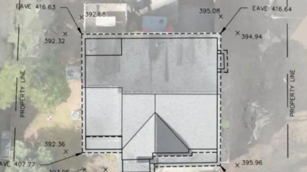
In property ownership, precise and accurate land measurements are vital. Whether you are selling, buying, or subdividing land, a boundary line survey and a 3D property survey offer vital information regarding property lines, land use, and potential conflicts. What is a Boundary Line Survey? A boundary line survey is a method of establishing the legal…